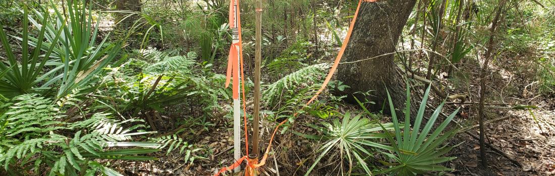
Where county boundaries are ill-defined, unmarked, or poorly marked, the South Carolina Geodetic Survey on a cooperative basis shall assist counties in defining and monumenting the locations of county boundaries and positioning the monuments using geodetic surveys. The South Carolina Geodetic Survey (SCGS) shall seek to clarify the county boundaries as defined in Chapter 3, Title 4. The SCGS shall analyze archival and other evidence and perform field surveys geographically to position all county boundaries in accordance with statutory descriptions. Physical and descriptive points defining boundaries must be referenced using South Carolina State Plane Coordinates.
Title
Frequently Asked Questions
Q: Why is the county boundary program Important?
Over time, the exact boundaries may not have been properly maintained and consequently became lost or unclear. Correctly identifying the county boundary pursuant to state law aids in the proper administration of government and services. Uncertainty regarding the location of the boundary may cause problems with voting, property taxes, emergency services, school attendance, property transactions, zoning, and other issues.
Q: Does this program result in a “new” county line or boundary?
No. The county boundary is not moved or changed by this process. This program is designed to identify the true location as described in state law. The result may identify discrepancies, other descriptions, or markings that are inconsistent with state law and need to be changed.
Q: Do I need to do anything to change my property to the correct county?
No. State and local officials will work together to ensure all appropriate steps are taken to complete a county boundary clarification.
Q: Do I need to have my property re-surveyed due to a county boundary clarification?
No. It is not necessary to have your property re-surveyed since a county boundary clarification does not change your title or deeded property. If you would like to have your property re-surveyed to reflect the location of the county boundary on your property, SCGS publishes a copy of the recorded plat with state plane coordinates so that a Professional Licensed Surveyor can accurately plot the boundary with regards to your property.
Q: Do I gain or lose property due to a county boundary clarification.
Neither. The clarification of a county boundary, even if it touches or crosses your property, does not change your title or your deeded property.
Q: How will the county boundary clarification affect my property taxes?
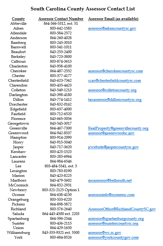
SCGS cannot determine how this will affect your property taxes. You will need to contact your county tax assessor and they will make a case-by-case determination. Please see the next page for a list of South Carolina County Assessor contact information.
Title
Contact List for County Assessors
Utilize the interactive map to stay up-to-date on the Status of the SCGS County Boundary Re-establishment program. Features such as address search allow you to find your property and see its relation to your county boundary. Click on the county boundary lines to find the link to the associated project website. Click on the entire county to see all of the project websites associated with that county. Zoom in on boundary lines or select from the map's Bookmark feature to find boundary monuments and their associated information (feature limited to select projects. More to come soon).
