Media
Title
Analytics Mapping Services
Title
Analytics Mapping Services
Data Integration and Analysis
Title
Online Analytics
Title
Map Examples
Media
Image
Media Description
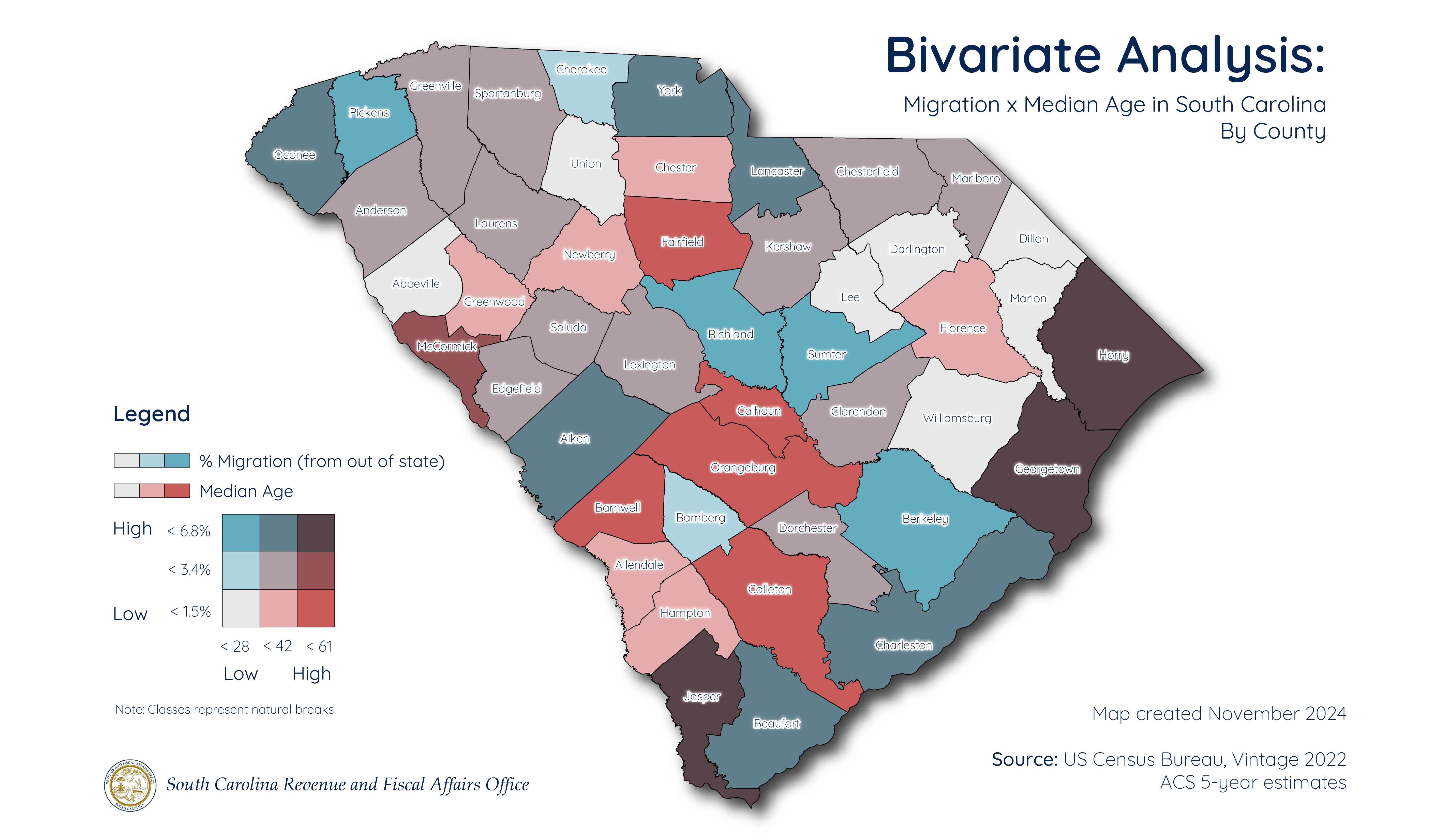
Bivariate Analysis of Median Age and Migration in South Carolina
Image
Media Description
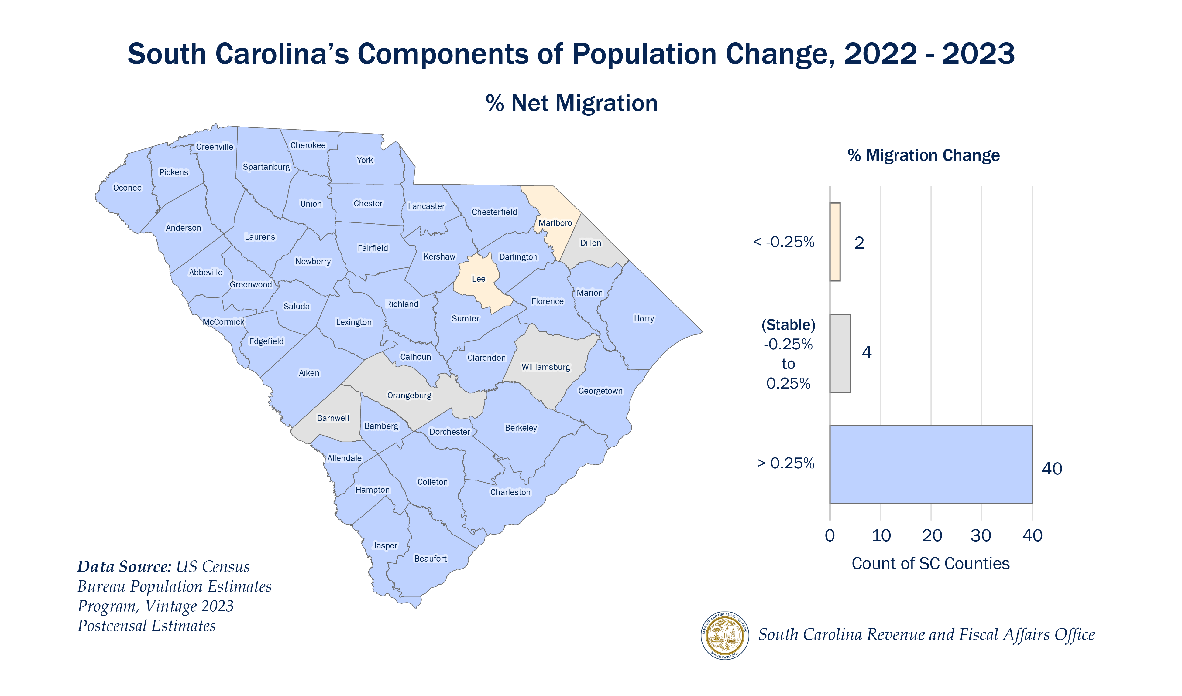
Micromap of SC out of state migration population change, 2022-2023
Image
Media Description
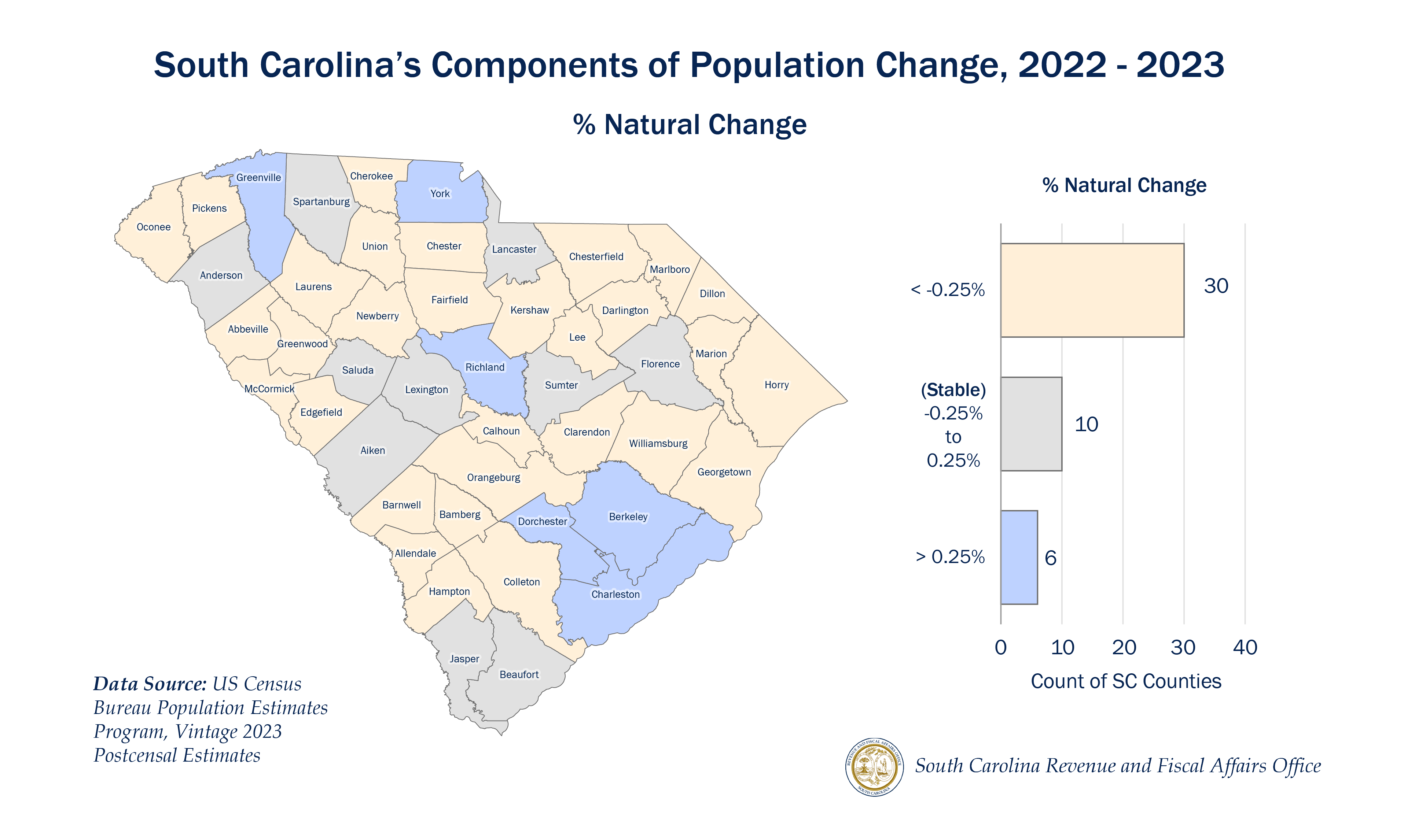
Micromap of SC natural population change, 2022-2023
Image
Media Description
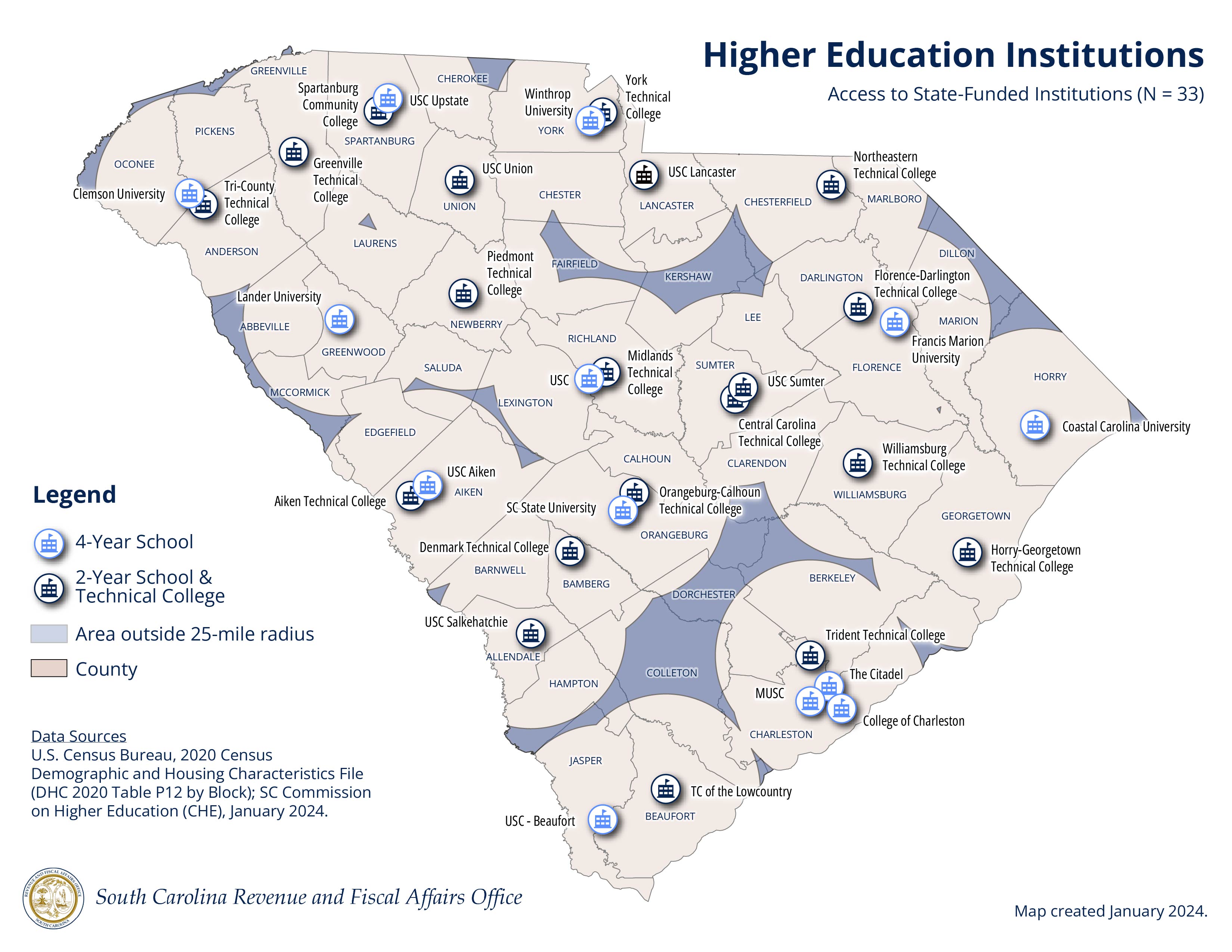
Map showing 25-mile gap analysis of SC CHE Higher Education Institutions
Image
Media Description
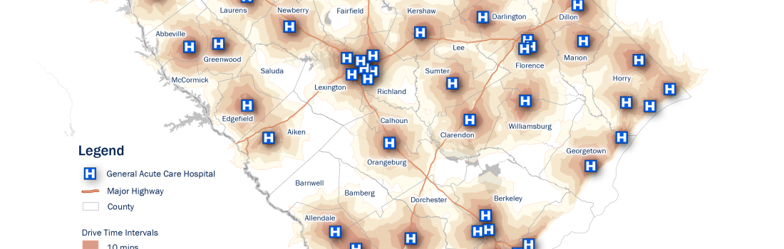
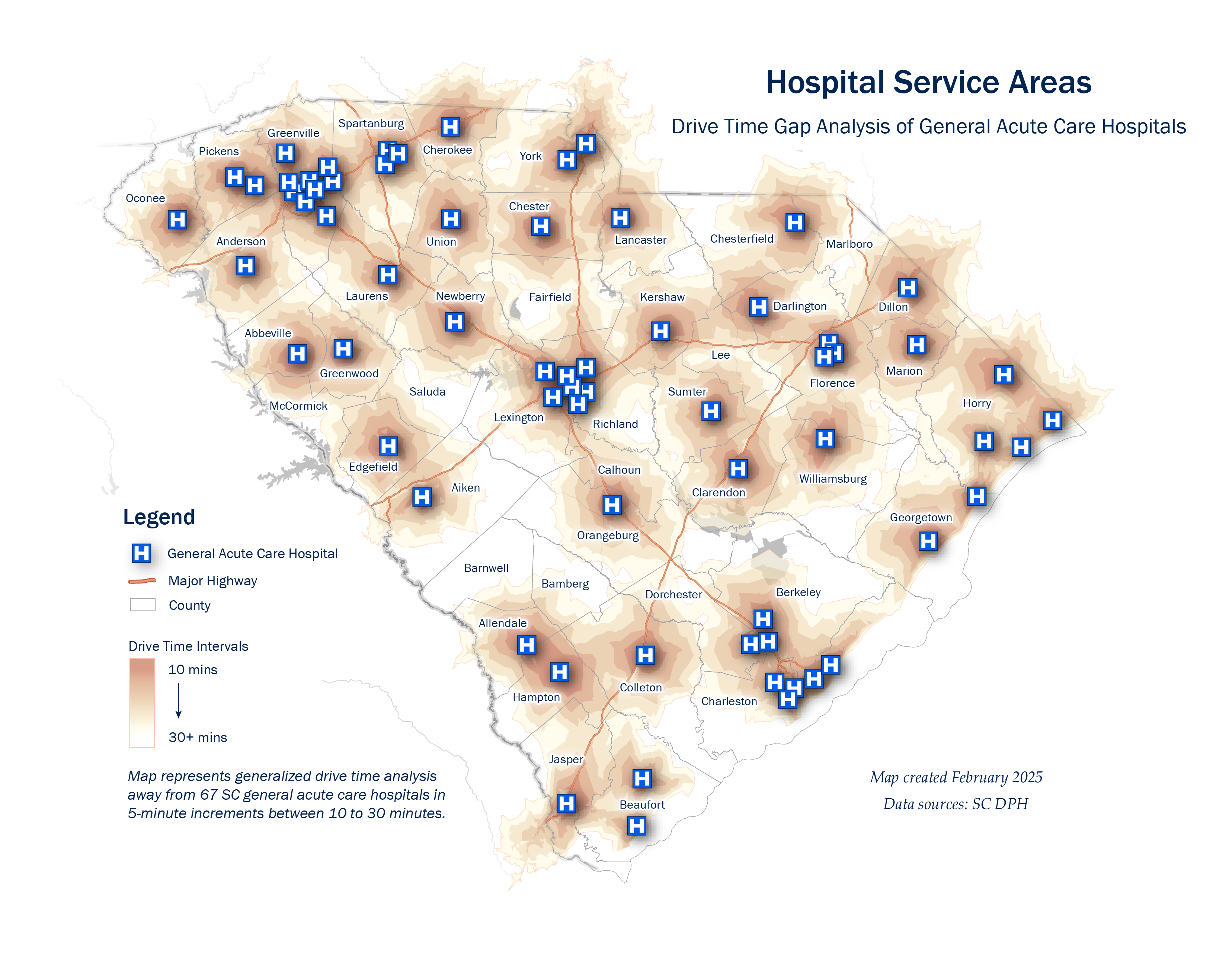
Drive Time Gap Analysis of General Acute Care Hospitals