SC Code of Law: (http://www.scstatehouse.gov/code/t04c003.php)
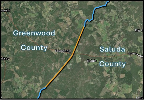
SECTION 4-3-290 Greenwood County
"Greenwood County is bounded as follows: beginning at the middle line of Saluda River at the northeast corner of Saluda County, thence along the line of Saluda County to its northwest corner on Mountain Creek...."
SECTION 4-3-470 Saluda County
"...thence along the northwestern boundary of Pine Grove township to the point on the old Charleston and Cambridge road, where it crosses Halfway Swamp Creek; thence down the middle of Halfway Swamp Creek to a point in the middle of Saluda River opposite the mouth of said creek..."
- Plat of 10062 acres from sleepy creek to mountain creek. Edgefield district May 13th, 1853.
- Text of Edgefield Advertiser article of August 4, 1870, describing boundaries of all Edgefield township boundaries, specifically Pine Beat.
- By Thomas B. Lee, C.E. Dated August 11, 1894.
- Plan and Profile of Proposed State Highway Greenwood Hwy. 21 to Hwy. 24. South Carolina State Highway Department.
- Plan and Profile of Proposed State Highway Saluda County from city limits of Saluda to Greenwood County line.1927. South Carolina State Highway Department.
- Plan and profile of proposed state highway showing bridge replacement at Halfway Swamp Creek. DKT. No 41.294. South Carolina State Highway Department.
- Plan and profile of proposed state highway showing bridge replacement at Halfway Swamp Creek. DKT. No 41.294. South Carolina State Highway Department.
- Plan of Greenwood portion of Pheasant Rd, today S-371 to Halfway Swamp Creek. South Carolina State Highway Department.
- From US-178 to the southwest. Showing a portion of Rt 610, the former path of US-178. South Carolina State Highway Department.
- Plan of Old US-178, now Century Farm Road, showing change in right of way at Greenwood County line. South Carolina State Highway Department.
- Screenshot of February 1994 Google Earth aerial photograph of pond or wetland at the recorded location of the headwaters of Little Mountain Creek. Reference to the 2024 National Hydrography Dataset identifying this location as a wetland at the terminus o
- Taken 1-18-1940. Note that grease pencil line is incorrectly placed. United States Department of Agriculture. CDX 7 28. Courtesy South Carolina Forestry Service.
- Taken 1-18-1940. United States Department of Agriculture. CDX 7 62. Courtesy South Carolina Forestry Service.
- Taken 1-18-1940. United States Department of Agriculture. CDX 7 64. Courtesy South Carolina Forestry Service.
- 2009 plat showing approximate County Line north of US-178 for TMS 7810-301-581. For Ridge Lumber Inc by Todd Surveys Inc.
- Greenwood County map as to County, Township and School District Boundaries, Streams, Railroads, and main County Roads. By WM. H. Yeldall and W.J. Kirk, dated 1898, reprinted 1929.
- 1975 plat showing old roadbed of US-178, now Century Farm Road, extending past S-154 toward County Line.
- 1986 plat showing lands west of S-154, omitting the extension of old US-178 roadbed.
- Good Hope Quad. Topography by photogrammetric methods, 1969. Field checked 1971. 1927 North American Datum. United States Geological Survey. Edition of 1971.
- Good Hope Quad. North American Datum of 1983. United States Geological Survey. Edition of 2020.
Disclaimer
The Revenue and Fiscal Affairs Office is providing access to these materials for educational and research purposes and is not aware of any U.S. copyright protection (see Title 17 of the United States Code) or any other restrictions in the provided materials.
Note that the written permission of the copyright owners and/or other rights holders (such as publicity and/or privacy rights) is required for distribution, reproduction, or other use of protected items beyond that allowed by fair use or other statutory exemptions. Responsibility for making an independent legal assessment of an item and securing any necessary permissions ultimately rests with persons desiring to use the item.