SC Code of Law: (http://www.scstatehouse.gov/code/t04c003.php)
SECTION 4-3-270.Georgetown County.
"...from Leneud's Ferry (abandoned) on the southwest bank of the Santee River; thence northeastward from said point on said line to the main road leading from Leneud's Ferry (abandoned) on the northeast bank of the Santee River; thence northeastward following the old main road leading from Leneud's Ferry (abandoned) across Potato Ferry (abandoned) on the Black River to Britton's Ferry (abandoned) on the Great Pee Dee River, the point of origin."
SECTION 4-3-520.Williamsburg County.
"...by Georgetown County from which it is separated by a line commencing on the Great Pee Dee River, the dividing line between Williamsburg, Marion and Georgetown Counties, and running to the road leading from Britton's and Bradley's Ferry, on said Great Pee Dee River, to Leneud's Ferry, on Santee River, the said road being the boundary line on the southeast separating it from Georgetown County,..."
- Preliminary Plat of county boundary survey
- An Act for building a bridge over the north branch of the Black River opposite to the landing of John Wallis, Esq, deceased, in the parish of Prince George Winyaw; … No. 718. 1744.Statutes At Large of South Carolina, edited by David McCord. Printed by A.S. Johnson, Columbia SC. 1836. Volume 9 pages 135 – 136.
- An Act Establishing Ferries Over Waccamaw And Pee Dee Rivers, and vesting the same in the persons therein mentioned; and appointing and empowering commissioners for making roads leading to the said Ferries. No. 843. 1756.Statutes At Large of South Carolina, edited by David McCord. Printed by A.S. Johnson, Columbia SC. 1836. Volume 9 pages 180 – 183.
- Plat for Theodore Gourdine showing road to Lenude’s Ferry on the north side of the Santee River. Wiliam Mouzon, surveyor. 1820.
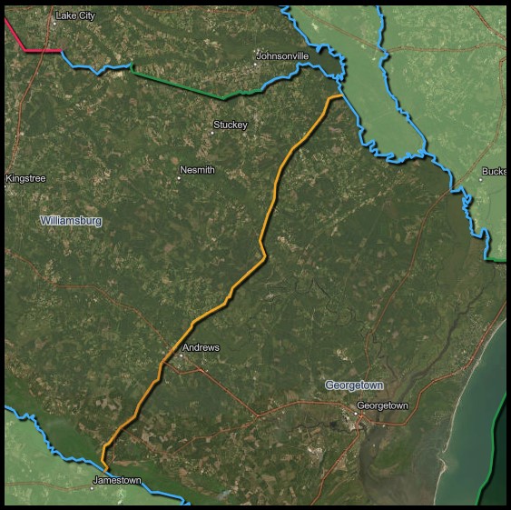
- Reconstruction of County Line Road/old Route 511 from Andrews south towards Jamestown.State Project No. 413-B Parts 1 2 3. South Carolina State Highway Department.
- Reconstruction of County Line Road/old Route 511 as SC-41 and 41 Business from Andrews town limits north to SC Route 527.State Project No. 674. Docket nos 22.206 & 45.221. South Carolina State Highway Department.
- Reconstruction of County Line Road/old Route 511 from the Black River to intersection with Route 512. Showing deviations above Big Dam Creek and Brown’s Ferry Road.Federal Aid Project No. 2511C and state dockets no. 22.215 & 45.219. South Carolina State Highway Department.
- Reconstruction of County Line Road/old Route 511 from the Black River to intersection with Route 512. Showing deviations above Big Dam Creek and Brown’s Ferry Road.Federal Aid Project No. F 412 (9). State docket no. 8 2245.202. South Carolina State Highway Department.
- Reconstruction of County Line Road/old Route 511 from Cedar Creek to Jamestown in Berkeley County. Showing deviation that is now Brown’s Chapel Road.Federal Aid Project No. 2511C and state dockets no. 22.215 & 45.219. South Carolina State Highway Department.
- Replacement of bridge over Smiths Branch on County Line Road / old Route 511 now Route 51, Browns Ferry Road.File: 2245.535. Project: BRF-121 (76). South Carolina Department of Transportation.
- 1802 drawing of area adjoining Britton’s Ferry for Stephen Britton by John Reels. Marion County Registrar of Deeds, plat book A page 86.
1850 plat along District Line Road north of Oak Ridge Bay, Williamsburg County Registrar of Deeds, plat book F page 37.
1837 plat adjoining road to Black Mingo Bridge from what is now Rhems, Williamsburg Registrar of Deeds, plat book F page 41.
1857 plat for same property as previous plat adjoining road to Black Mingo Bridge, Williamsburg Registrar of Deeds plat book G page 73.
1854 plat depicting road from Black Mingo Bridge to Britton’s Ferry as District Line, Williamsburg County Registrar of Deeds, plat book G page 40.
1891 plat depicting Lenud’s Ferry on the Santee River, Georgetown County Registrar of Deeds, plat book N page 187.
- Plan and profile of proposed state highway, Georgetown and Williamsburg counties US 521 Andrews Bypass from SC Route 41 Truck Route to US 521 East of Andrews.File no. 22.619. Project No. BNH-WCCB (00). South Carolina Department of Transportation.
- Proposed Pans for Georgetown Williamsburg County SC Route 41 (County Line Rd) Intersection improvement at SC Rout 51 (Browns Ferry Rd and Road S-24 (Neismith Rd).Project ID P027172. South Carolina Department of Transportation.
- An accurate map of North and South Carolina: with their Indian frontiers, shewing in a distinct manner all the mountains, rivers, swamps, marshes, bays, creeks, harbours, sandbanks and soundings on the coasts; with the roads and Indian paths; as well as the boundary or provincial lines, the several townships and other divisions of the land in both provinces. Henry Mouzon. 1775. South Caroliniana Library Map Collection.
- “The district of Georgetown shall be divided into four counties as follows: … one county beginning at Linud’s ferry on Santee river, thence along the road to Potatoe ferry to Shepherd’s ferry on Blac Mingo, to Britton’s ferry on Great Peedee…”No. 1263. 1785. The Statutes at Large of South Carolina, edited by Thomas Cooper. Volume 4 pages 661 to 665.
- An Act for Laying Out a Public Road from Peter Lieubrey’s Ferry to Jonathan Skeine’s Landing to Mr. Rober Scriven’s Plantation, opposite Georgetown, in the Parish of Prince George Winyaw. No. 552, 1733.Statutes At Large Of South Carolina edited by David McCord. Printed by A.S. Johnson, Columbia SC. 1836. Volume 9 pages 74 – 75.
- Reference to Shepherd’s Ferry on the historical marker commemorating the Revolutionary War skirmish at what is now the Black Mingo Landing below the current bridge. Historical Marker Database. Retrieved 8/30/2023.
- Prepared by the South Carolina State Highway Department in cooperation with the US Department of Agriculture Bureau of Public roads. 1939. Compiled from USC & GS air photo maps of 1934 and state-wide highway planning survey rural road inventory.
- Prepared by the South Carolina State Highway Department in cooperation with the US Department of Agriculture Bureau of Public roads. 1939. Compiled from USC & GS air photo maps of 1934 and state-wide highway planning survey rural road inventory.
- A Map of the Province of South Carolina with all the rivers, creeks, bays, inlets, islands inland navigation, soundings time of high water on the sea coast, roads, marshes, ferrys, bridges, swamps, parishes churches, towns, townships, county parish district and provincial lines.
James Cook. 1773. South Caroliniana Library Map Collection. - Ca. 1820 map showing property owners and features of Georgetown District. South Carolina Department of Archives and History.
- Map of the coastal features of South Carolina and Georgia, including accessible roads.Published & Lithographed by Evans & Cogswell, 3 Broad St, Charleston. S.C. Lithograph, c.1861. South Caroliniana Library Map Collection
- “Georgetown District, South Carolina, surveyed by Wm. Hemingway, 1820; improved for Mills’ Atlas, engineered by H.S. Tanner & assistants.” 1825. Shows locations of property owners. Robert Mills.South Caroliniana Library Map Collection.
- Map of Willliamsburgh District, South Carolina, surveyed by I. Harlee, 1820; improved for Mills’ Atlas, 1825. Robert Mills.South Caroliniana Library Map Collection.
- 1970 plat for International Paper Company showing County Line Road crossing the Coastline Railroad below Potatoe Ferry. Georgetown Registrar of Deeds, plat book N page 93.
2000 plat adjoining Reds Landing Road where old County Line Road meets it. Georgetown Registrar of Deeds, slide 376 page 7A.
2012 plat of lot on old bridge ramp at Potatoe Ferry. Georgetown Registrar of Deeds, plat book 1859 page 307.
- 1907 for Southern Kraft Corp of parcel at northern terminus of County Line Road, showing the bluff used as the ferry landing. Georgetown County Registrar of Deeds, plat book N page 67.
2004 plat of Britton’s Ferry site. Williamsburg Registrar of Deeds, plat book 1100 page 9.
- 1943 map of Property owned by Marion Cotton Oil Company, formerly J. D. Rhem, Georgetown and Williamsburg Counties, SC. Content 739.3 acres, exclusive of highway, West Virginia Paper Co right of ways and a Gin Lot. June 1943. Johnson A. Roberts, C. E. Showing highway right of way from old bridge on Church Creek/Smith Creek to Rhems. Georgetown County Registrar of Deeds, plat book M page 53.
1959 map of 270 acres of land situate on Mingo Creek and owned by D. D. Rhem. Surveyed 29 September 1959 by Samuel M. Harper, RLS. Showing the old intersection of County Line Road at Rhems. Georgetown County Registrar of Deeds, plat book P page 68.
- 1996 plat of parcel north of Dawnshire Road, Georgetown County Registrar of Deeds, slide 205 page 9A.
1998 plat of parcels adjoining Wallace Cemetery above Big Dam Swamp, Georgetown County Registrar of Deeds, plat book S-271 page 9B.
2020 plat of parcels adjoining Dawnshire Road, Georgetown County Registrar of Deeds, plat book 3709 page 44.
- Ca. 1960 map of International Paper Company Parcel 85-A2 showing old road deviation just northeast of Gourdines Chapel on County Line road. Williamsburg Registrar of Deeds plat book 141 page 180.
2007 plat of Quarry Lake tract prepared for International Paper Co. Inc., Georgetown County and Williamsburg County, South Carolina. Surveyed by Robert A. Warner, PLS # 15177. Georgetown County Registrar of Deeds, slide number S-654 page 3.
- A collection of reports by the South Carolina Institute of Archaeology and Anthropology
and New South Associates for the SC Department of Transportation, prepared prior to the relocation of the SC-41 bridge over the Black River, near the site of Potatoe Ferry. Ca. 2000.
- Three small deviations in the old road north east of Andrews and the Black River in the vicinity of Big Dam Swamp. CDW 5 30. United States Department of Agriculture. Courtesy South Carolina Forestry Commission.
- Aerial of the vicinity of what is now Quarry Lake, showing deviation of the old road now known as Browns Chapel Road. CDW 6 78. United States Department of Agriculture. Courtesy South Carolina Forestry Commission.
- West of the current road, then under construction, a bridge spans the site of Potatoe Ferry, now known as Red’s Landing on the Black River. CDW 6 25. United States Department of Agriculture. Courtesy South Carolina Forestry Commission.
- Aerial of County Line Road to north east of Guinard’s Chaple showing deviation in road bend. CDW 7 16. United States Department of Agriculture. Courtesy South Carolina Forestry Commission.
- Aerial of Liston Road (old County Line Road) and Brown’s Ferry Road leading to the Rhems intersection. CDW 8 66. United States Department of Agriculture. Courtesy South Carolina Forestry Commission.
- Aerial of the County Line Road terminus at Britton’s Ferry. ASQ 2A 65. United States Department of Agriculture. Courtesy South Carolina Forestry Commission.
- Aerial of then County Line Road (now Brown’s Chapel) at the southern terminus just above Lenud’s Ferry. ASQ 6A 89. United States Department of Agriculture. Courtesy South Carolina Forestry Commission.
- Aerial of then County Line Road (now Brown’s Chapel Road) showing deviations north of Lenud’s Ferry. ASQ 6A 87. United States Department of Agriculture. Courtesy South Carolina Forestry Commission.
- Aerial of Lenud’s Ferry in operation, with County Line noted. ASQ 6A 90. United States Department of Agriculture. Courtesy South Carolina Forestry Commission.
- Jamestown Quadrangle, South Carolina, 1943.
Andrews Quadrangle, South Carolina, 1943.
Henry Quadrangle, South Carolina, 1943.
Rhems Quadrangle, South Carolina, 1943.
Outland Quadrangle, South Carolina, 1943.
Mapped by the Army Map Service. Published for civil use by the Geological Survey.
Topography by photogrammetric methods from aerial photographs taken 1942 and planetable surveys 1943. 1927 North American datum.
Johnsonville Quadrangle, South Carolina, 1943. Mapped by Tennessee Valley Authority under direction of the Chief of Engineers, U. S. Army, 1943. Wide-angle photography for TVA, 1943. 1927 North American datum.
- Map of Willliamsburgh District, South Carolina, surveyed by I. Harlee, 1820; improved for Mills’ Atlas, 1825. Robert Mills. South Caroliniana Library Map Collection.
- A brief history of the trading post and ferry on the Pee Dee called Sawkee Bluff or Britton’s Ferry. No author. RootsWeb. 2001.
Disclaimer
The Revenue and Fiscal Affairs Office is providing access to these materials for educational and research purposes and is not aware of any U.S. copyright protection (see Title 17 of the United States Code) or any other restrictions in the provided materials.
Note that the written permission of the copyright owners and/or other rights holders (such as publicity and/or privacy rights) is required for distribution, reproduction, or other use of protected items beyond that allowed by fair use or other statutory exemptions. Responsibility for making an independent legal assessment of an item and securing any necessary permissions ultimately rests with persons desiring to use the item.