
Height Modernization was an initiative created in the 1990’s and early 2000’s to establish accurate, reliable heights using Global Navigation Satellite System (GNSS) technology in conjunction with traditional leveling, gravity, and modern remote sensing information.
Height Modernization is a program within NOAA's National Geodetic Survey (NGS) that provides accurate height information by integrating Global Positioning System (GPS) technology with existing survey techniques. For years, GPS has been used to determine accurate positions (latitude and longitude), but now, by following Height Modernization standards, specifications and techniques, GPS can efficiently establish accurate elevations for all types of positioning and navigational needs. SCGS follows the ( + 2 cm ) vertical specifications for all GPS Height Modernization Projects.
Elevation information contributes to informed decision making and impacts a wide range of important activities including mapping and charting, flood risk determination, transportation, land use and ecosystem management.
Title
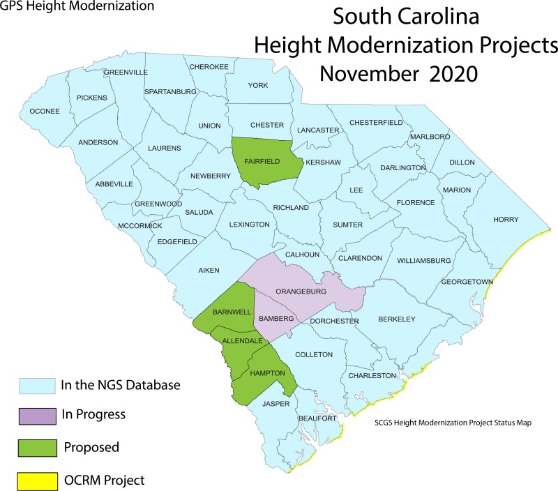
SCGS Height Modernization Project Status Map
When an area is chosen for a height modernization project (usually a county/ counties) the first step is to go into that area and do a recon/ inventory of all the NGS published survey monuments. Each monument is found (unless it is destroyed) cleaned, flagged and a report is completed to update the current published description.
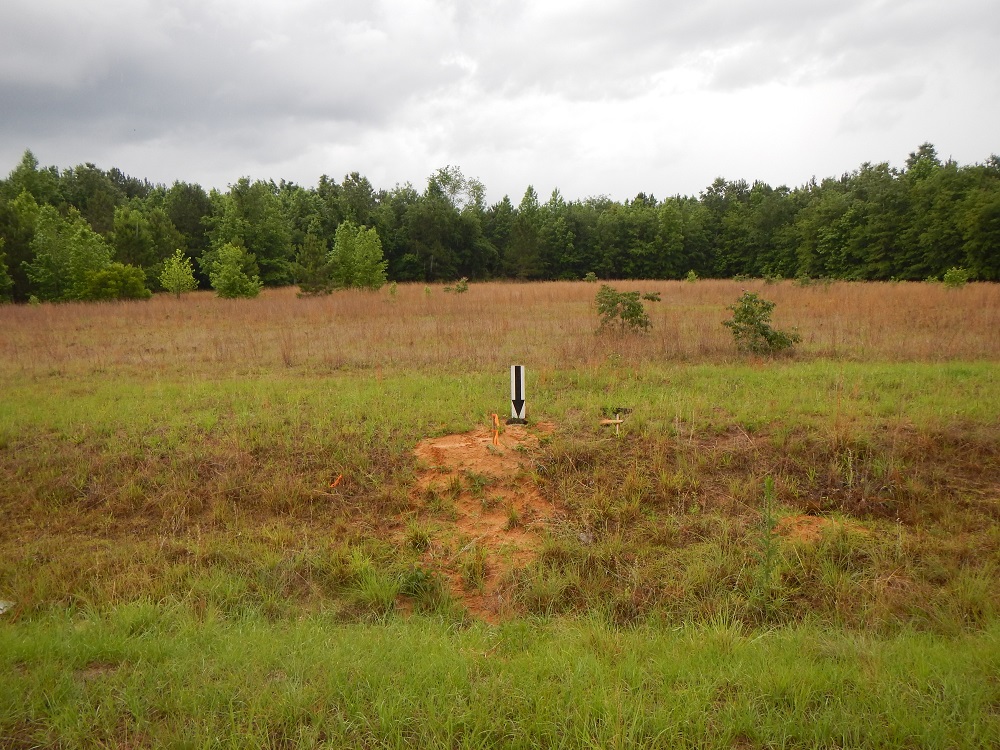
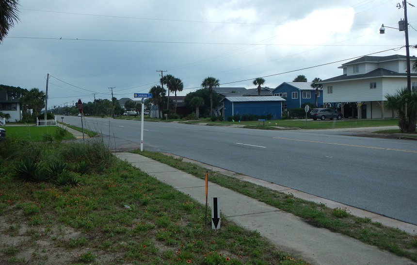
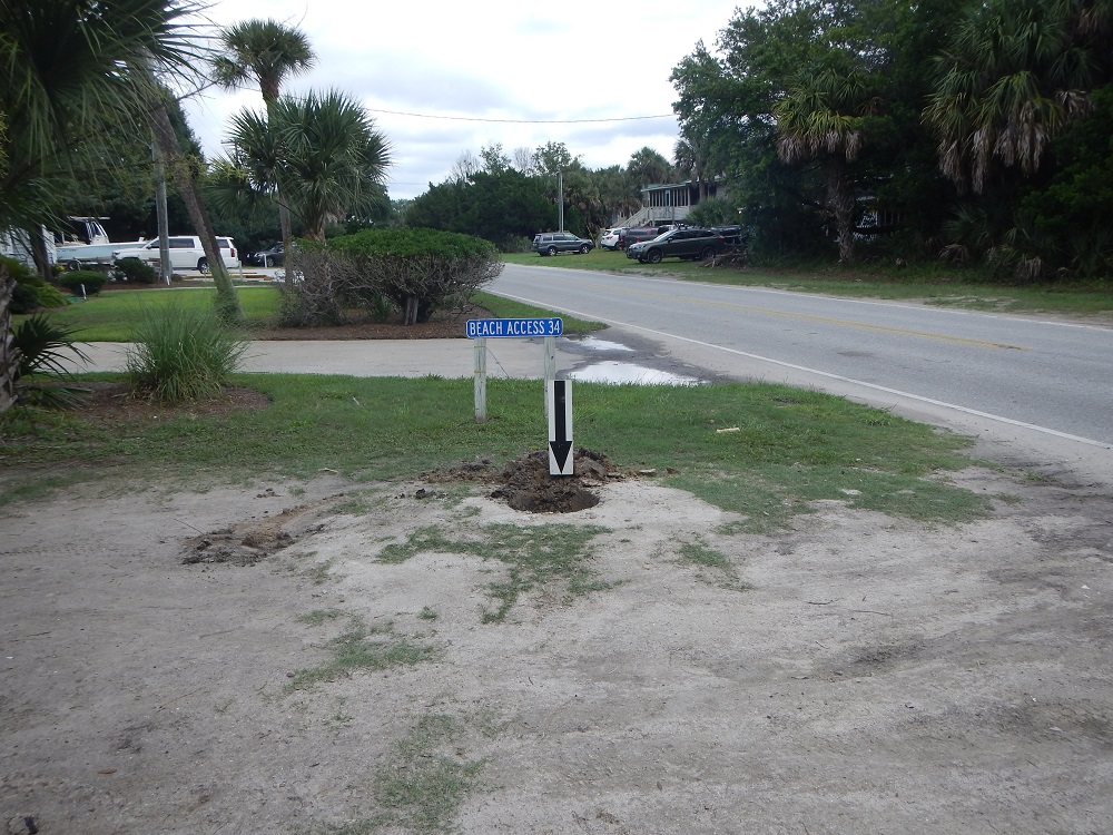
Once an inventory has been taken on existing survey marks in the focus area, a plan can be made to "fill in the gaps" or densify the control monuments in the area. Using GIS areas are selected before hand that seem to have clear views of the horizon to eliminate interference when GPS observations are completed. The locations are then scouted by a field crew and an obstruction observation is completed to insure minimal GPS interference. Once SC811 has okayed the spot to be dug the monuments are established.
Creating and maintaining accurate survey control monuments is very important. SCGS utilizes multiple survey control monument types depending on the location they will be set. Monument locations are selected based on monument density in an area, as well as the ability to be observed using GPS observations (clear view of the sky 15 degrees off the horizon and up).
Title
Standard Concrete Survey Monuments
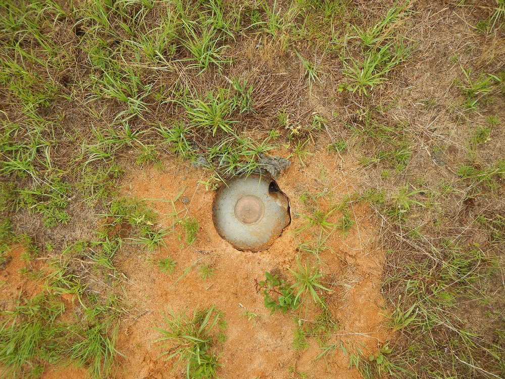
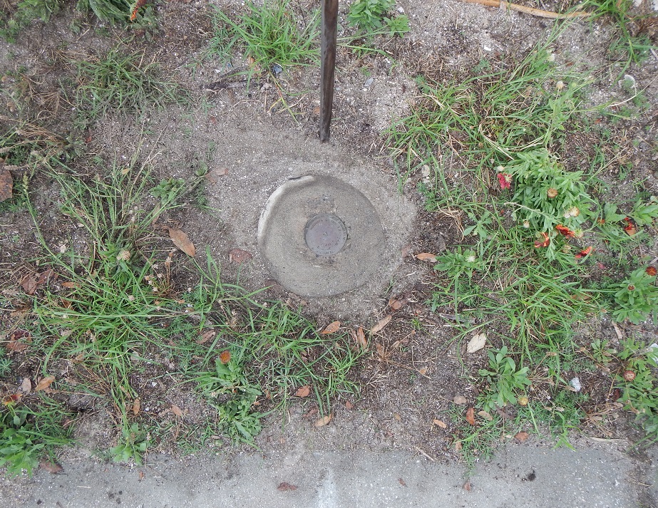
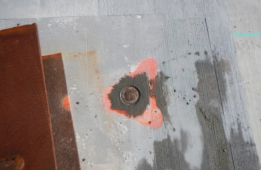
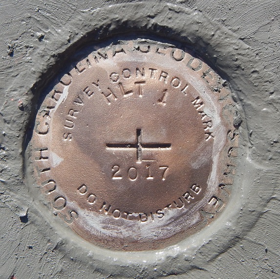
The most common type of monument set by SCGS is a standard concrete monument with a brass disk set in the top of it. These are created by digging a flared base hole approximately 4 feet in depth. It is then filled with concrete. A form is used for the top of the monument and a stamped brass disk is set in top while the cement is still wet. These monuments are used anywhere in the state with stable, dry ground that can be dug using hand tools.
Title
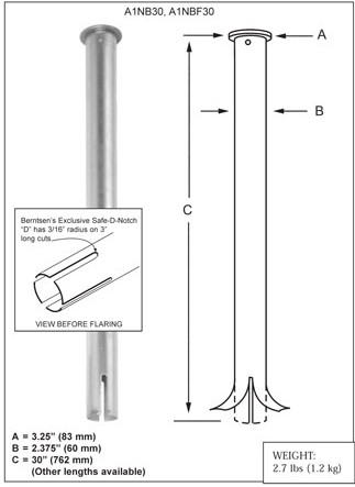
Flarable Pipe Monuments
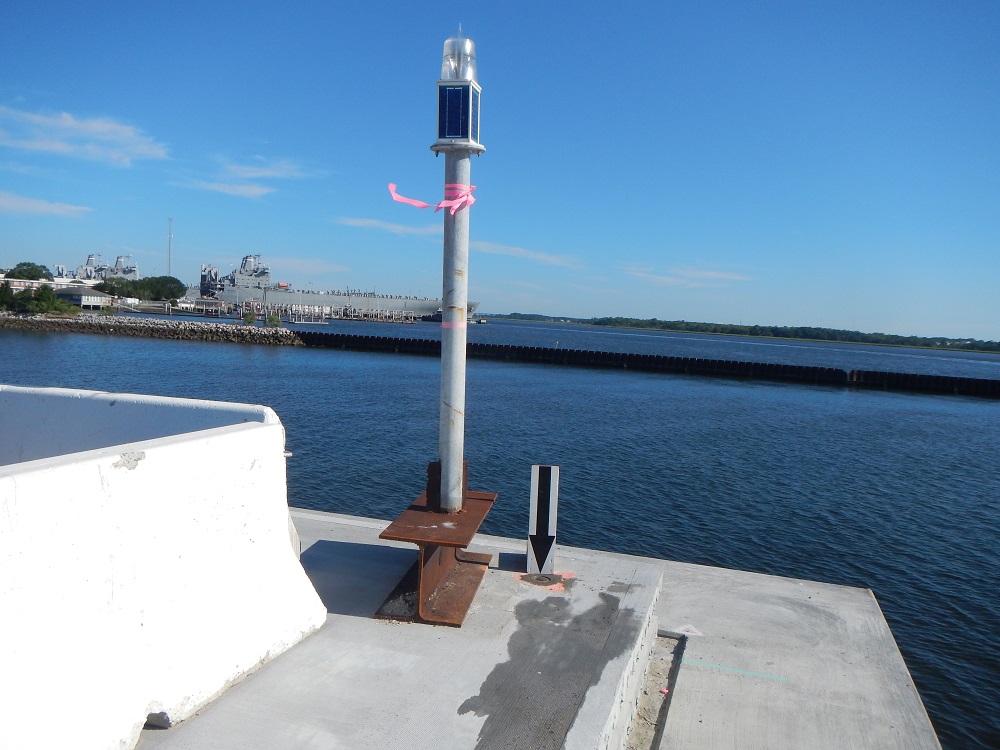
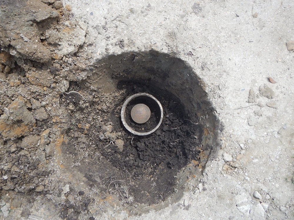
Pipe monuments are used in areas where the ground is not stable enough to hold a concrete monument. Historically SCGS has used pipe monuments in coastal areas as well as tidal areas.
Monuments are set by digging a hole approximately 4 feet deep. A small amount of gravel or dry concrete is then tamped into the bottom of the hole to create a solid base. The disk on top of the monument is stamped and the base is flared. The monument is set in the hole. It is then backfilled and tamped periodically to compact the earth around the monument ensuring a stable monument horizontally and vertically. After the hole is filled half way a 6" PVC collar is added around the pipe monument and backfilled. The PVC collar protects the monument and ensures it is not disturbed.
Title
Monuments Set in Stone/ Poured Concrete
On occasion survey monuments will be set in stone outcrops or in pre-poured concrete such as piers, bridge abutments, and sidewalks.
To establish a monument in stone or concrete SCGS uses a hammer drill and multiple bits to counter sink a hole into the surface that will accept one of SCGS standard brass survey monument disks. Once the hole is prepped/cleaned and the brass disk is stamped, a two part epoxy is mixed and filled into the counter sunk hole. The brass disk is then pressed into the hole.
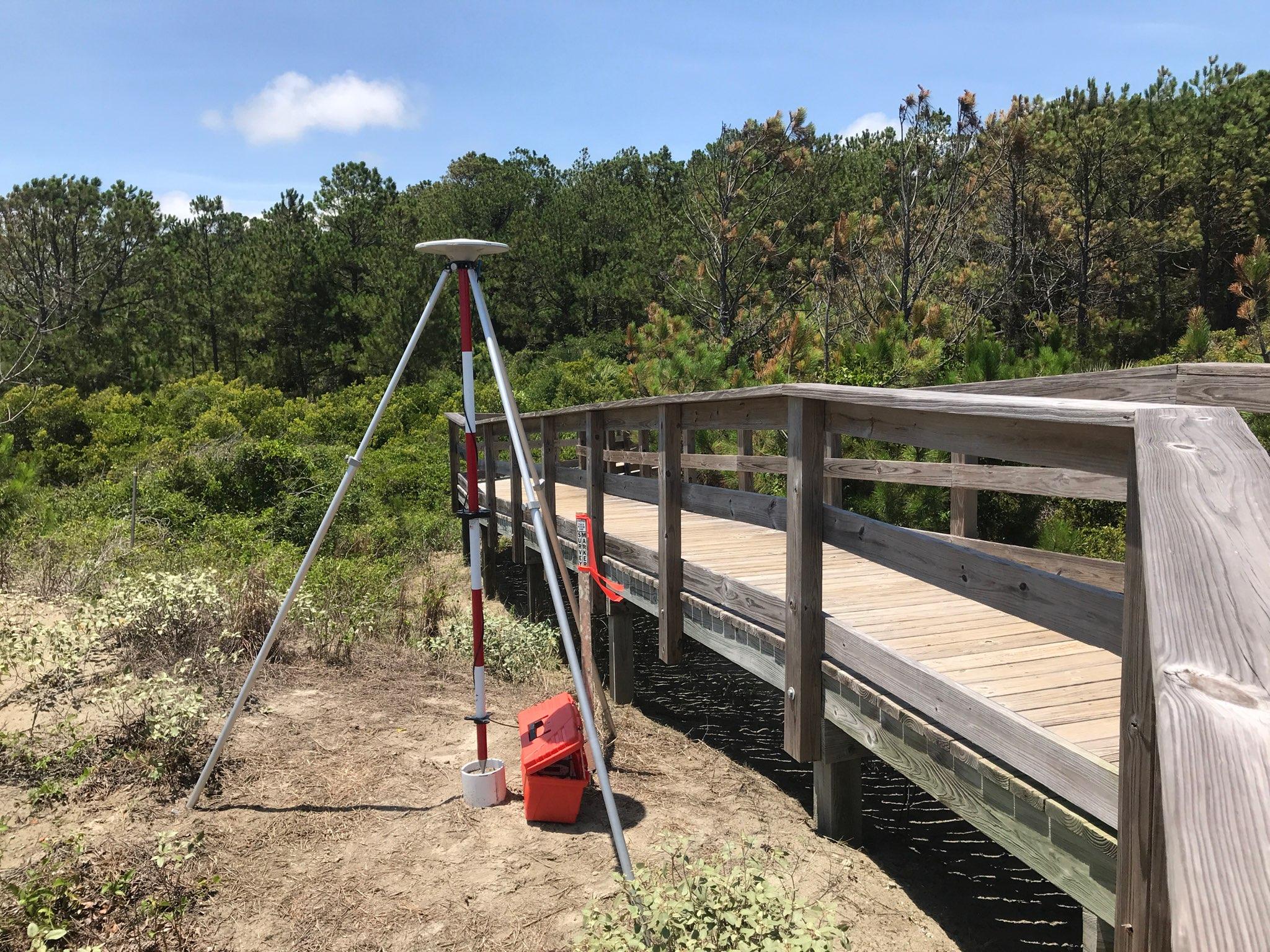
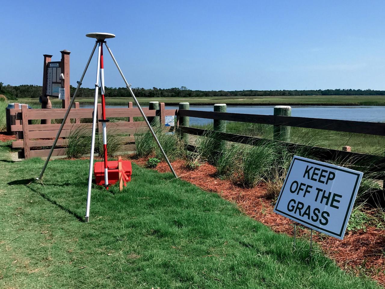
To conduct GPS observations a 2.0m fixed height tripod is used with a Trimble Zephyr antenna, connected to a Trimble R9 receiver with a connected backup battery. Observations are a minimum of 60mins. Multiple GPS observations are conducted on new survey monuments and existing quality monuments. Usually conducted by a crew of 4 monuments are observed multiple times by multiple people to ensure accuracy.
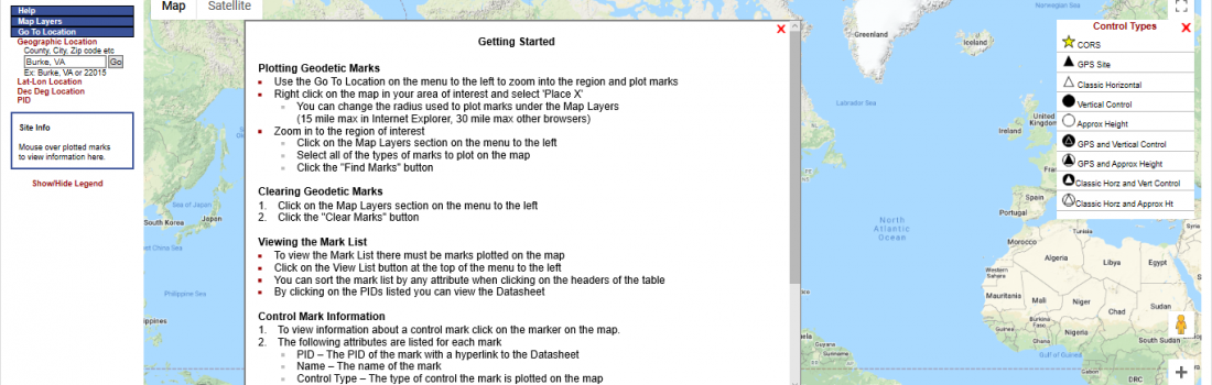
Use the data explorer to find survey monuments in your area. Find your area of interest on the map. Then click the map layers tab on the left hand side of the data explorer. You can then set the search radius you would like to search in. Then click the find marks button to find survey monuments. Click on individual monument icons to open the monument datasheets.
If you have found a survey monument and want to know what the published coordinates, elevation or description are use the NGS Station Name Search tool. Enter the name, and State you are located in, then click submit. A station list will populate, select the station you want to see and click the Get Datasheet button at the bottom of the screen.
